ၾၢႆႇ:Fiji location map.svg

Size of this PNG preview of this SVG file: 467 × 599 ၽိၵ်ႉသႄႇလ်. resolutionsတၢင်ႇဢၼ် : 187 × 240 ၽိၵ်ႉသႄႇလ် | 374 × 480 ၽိၵ်ႉသႄႇလ် | 599 × 768 ၽိၵ်ႉသႄႇလ် | 798 × 1,024 ၽိၵ်ႉသႄႇလ် | 1,596 × 2,048 ၽိၵ်ႉသႄႇလ် | 728 × 934 ၽိၵ်ႉသႄႇလ် ။
ၾၢႆႇငဝ်ႈတိုၼ်း (ၾၢႆႇ SVG, ၸိုဝ်ႈ 728 × 934 pixels, သႅၼ်းၾၢႆႇ : 144 KB)
ၵႂၢမ်းယေႃး
| ၶေႃႈသပ်းလႅင်း |
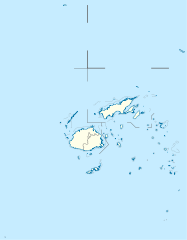
Deutsch: Positionskarte von Fidschi
Quadratische Plattkarte, N-S-Streckung 104 %. Geographische Begrenzung der Karte:
English: Location map of Fiji
Equirectangular projection, N/S stretching 104 %. Geographic limits of the map:
|
| ဝၼ်းထီႉ | |
| ငိူၼ်ႈငဝ်ႈတိုၼ်း |
ၵၢၼ်ၶွင်တူဝ်, using
|
| ၽူႈတႅမ်ႈလိၵ်ႈ | NordNordWest |
| ၶေႃႈလူတ်းပွႆႇ (ၶိုၼ်းၸႂ်ႉ ၾၢႆႇဢၼ်ၼႆႉ) |
I, the copyright holder of this work, hereby publish it under the following license: ၾၢႆႇဢၼ်ၼႆႉၼႆႉ မီးသုၼ်ႇဝႂ် ပႃႈတႂ်ႈ ၶွင် Creative Commons Attribution-Share Alike 3.0 Unported ဝႆႉၼႆႉ။
|
| Other versions |
Derivative works of this file: |


|
This map has been made or improved in the German Kartenwerkstatt (Map Lab). You can propose maps to improve as well.
|
ပိုၼ်းၾၢႆႇ
တဵၵ်းၼိူဝ် ဝၼ်းထိ/ၶၢဝ်းယၢမ်း တႃႇႁၼ်ၾၢႆႇ ၼႂ်းဝၼ်းၼၼ်ႉ
| ဝၼ်းထီႉ/ၶၢဝ်းယၢမ်း | ႁၢင်ႈလဵၵ်ႉ | သႅၼ်းမၼ်း | ၽူႈၸႂ်ႉတိုဝ်း | တၢင်းႁၼ်ထိုင် | |
|---|---|---|---|---|---|
| ယၢမ်းလဵဝ် | 10:19, 19 သႅပ်ႇထႅမ်ႇပႃႇ 2011 | | 728 × 934 (144 KB) | NordNordWest | corr |
| 16:04, 11 ဢွၵ်ႇထူဝ်ႇပႃႇ 2009 |  | 728 × 934 (218 KB) | NordNordWest | {{int:filedesc}} {{Information |Description= {{de|Positionskarte von Fidschi}} Quadratische Plattkarte, N-S-Streckung 104 %. Geographische Begrenzung der Karte: * N: 12.3° S * S: 21.8° S * W: 174.4° O * O: 177.9° W {{en|Location map of |
လွင်ႈၸႂ်ႉတိုဝ်း ၾၢႆႇ
4 ၼႃႈလိၵ်ႈ ၵွင်ႉမႃးၸူးၾၢႆႇၼႆႉ:
လွင်ႈၸႂ်ႉတိုဝ်းၾၢႆႇလူမ်ႈၽႃႉ
Wikis ၸိူဝ်းဢၼ်ၸႂ်ႉဝႆႉ ၾၢႆႇဢၼ်ၼႆႉ:
- ၸႂ်ႉဝႆႉ af.wikipedia.org
- ၸႂ်ႉဝႆႉ an.wikipedia.org
- ၸႂ်ႉဝႆႉ ar.wikipedia.org
- ၸႂ်ႉဝႆႉ arz.wikipedia.org
- ၸႂ်ႉဝႆႉ ast.wikipedia.org
- Suva
- Módulu:Mapa de llocalización/datos/Islles Fixi
- Mar de Koro
- Módulu:Mapa de llocalización/datos/Islles Fixi/usu
- Universidá del Pacíficu Sur
- Plantía:Mapa de llocalización
- Plantía:Mapa de llocalización/doc
- Aeropuertu Internacional de Nadi
- Aeropuertu de Rotuma
- Islles Yasawa
- Yanuca Lailai
- Levuka
- Lautoka
- ၸႂ်ႉဝႆႉ azb.wikipedia.org
- ၸႂ်ႉဝႆႉ az.wikipedia.org
- ၸႂ်ႉဝႆႉ ba.wikipedia.org
- ၸႂ်ႉဝႆႉ be-tarask.wikipedia.org
- ၸႂ်ႉဝႆႉ be.wikipedia.org
တူၺ်း ၾၢႆႇmore global usage ဢၼ်ၼႆႉ